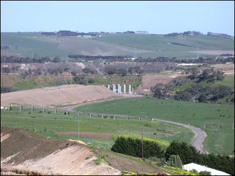
It's actually quite difficult to get a view of Geelong's second river, the Moorabool.
This river has had a hard life – in the past it has been diverted because of the huge limestone quarry for the cement works at Fyansford (since closed but the council has just approved a big housing development on the site), dammed at Lal Lal for Ballarat's water supply, weed-infested and polluted with salt, agricultural sprays and fertilisers. Upstream a lot of restoration work is being done by landholders guided by Landcare and the Corangamite Catchment Management Authority, but very little water actually runs down the river at present because of the dam and the drought. The very wide and deep valley tells a story of past floods. Since European occupation there have been a number of devastating floods resulting in loss of property and stock.
Now there are major roadworks at Fyansford where the Moorabool meets the Barwon River. Geelong is finally getting a ring road – a bypass to take the beach-goers and transports around the city instead of through it. To build it the engineers have had to design bridges to cross the two rivers.
I set out to get a photo and found myself in courts, no-through roads and suburbia, finally finding a promising spot near Dunwinnie Crt in Hamlyn Heights and climbing though a fence to get to the edge of the road excavations. The photo below shows the start of the bridging of the Moorabool River.
Travellers in a year or so will get a completely different view of Geelong, or rather, the western edge of Geelong, and the bonus will be views of a previously hidden valley.
Wednesday 29 August 2007
Hidden valley
Subscribe to:
Post Comments (Atom)

No comments:
Post a Comment